It has been about a month since I last wrote for the blog, and a lot has happened here. Namely, a huge wildfire swept through the lower valley down to the Columbia River, east and north into the Okanogan Valley, and south towards Chelan. We live in an area that was never threatened, but when the main transmission line into the valley burned along a 4-mile stretch of Highway 20, the entire valley was without power for a little over a week. Our internet service provider, Methownet, went down along with the power outage. Fortunately, I have cellular data for my iPad (with Verizon, which usually had service despite some challenges, unlike AT&T which was non-existent for its customers). So I was able to get news from the internet, and send out emails (using my Gmail account) to family and friends as events unfolded.

Taken from our house on July 16 as the northern part of the fire started to blow up
Since I was able to keep in touch, I don’t want to re-hash everything here, but thought I would fill in my wider readership and also put some links and photos up. I have had a hard time getting started on this, and will try to keep it simple.
The fires started with lightning strikes on Monday July 14. It was extremely hot that week, up to 105F (40C) with strong southeasterly winds. The worst day was Thursday July 17. According to the Methow Valley News, almost half of the nearly 400 square miles that have burned were consumed in a 9-hour period that day. It swept down the lower valley and onto the town of Pateros, which is where the Methow River flows into the Columbia River. A lot of people lost their homes that day, and the power line to the valley was de-energized when they could not save it from the fire. That line comes over Loup Loup pass between the Methow and Okanogan valleys.
Here is a very interesting fire progression map. The link is to a PDF file. Each color is a different day. The large dark green area is July 17th.
CarltonComplex fire progression 072714r
We used to live up Benson Creek, which is a small side valley between Twisp and Carlton, running up to the east from Hwy 153. We moved from there about 4 years ago and now live about 2 miles from Winthrop. On July 17, the northern part of the fire burned south through Finley Canyon, then through the Wenner Lakes area which connects Finley Canyon to the top of the Benson Creek Valley. We have friends who live just where that connecting draw comes out and they, of course, were evacuated – taking all their horses, dogs & cat, etc with them.
That evening, their daughter and her boyfriend drove up from Wenatchee and passed through Pateros just as the fire reached there. She took video on 2 cell phones and later put together a YouTube video which I will share with you. Note: she has the DATE wrong, it was actually Thursday July 17 (not July 14). The first part is driving up the lower valley from Pateros to Benson Creek. She talked the firefighters into letting her go up to her parents’ place and you can see the fires raging behind it in the Wenner Lakes draw. Her parents’ place survived the night, but the neighbors immediately above them burned to the ground. The next day they were up there defending the outbuildings from the fire, with the help of fire crews of course, and they did save their place.
Here is a picture taken by another friend whose home was barely saved up on Balky Hill, just NE of Twisp. His comment:
Raleigh and my house was potentially headed for the ash pile when the cavalry came over the hill at the 11th hour & 59 minutes. I’ll never forget seeing this. This was 1/4 mile from our house. On one side of fire retardant stripe it’s black for 25 miles to the Columbia River. On the other side, including our house, it’s like it was before the fire. Amazing! We feel grateful to have a house and sad for all that’s been lost.

On Monday July 21, Rick and I drove down to check on another friends’ place just north of Carlton, then drove up Benson Creek to check in with our friends there. Here are a few pictures I took that day:
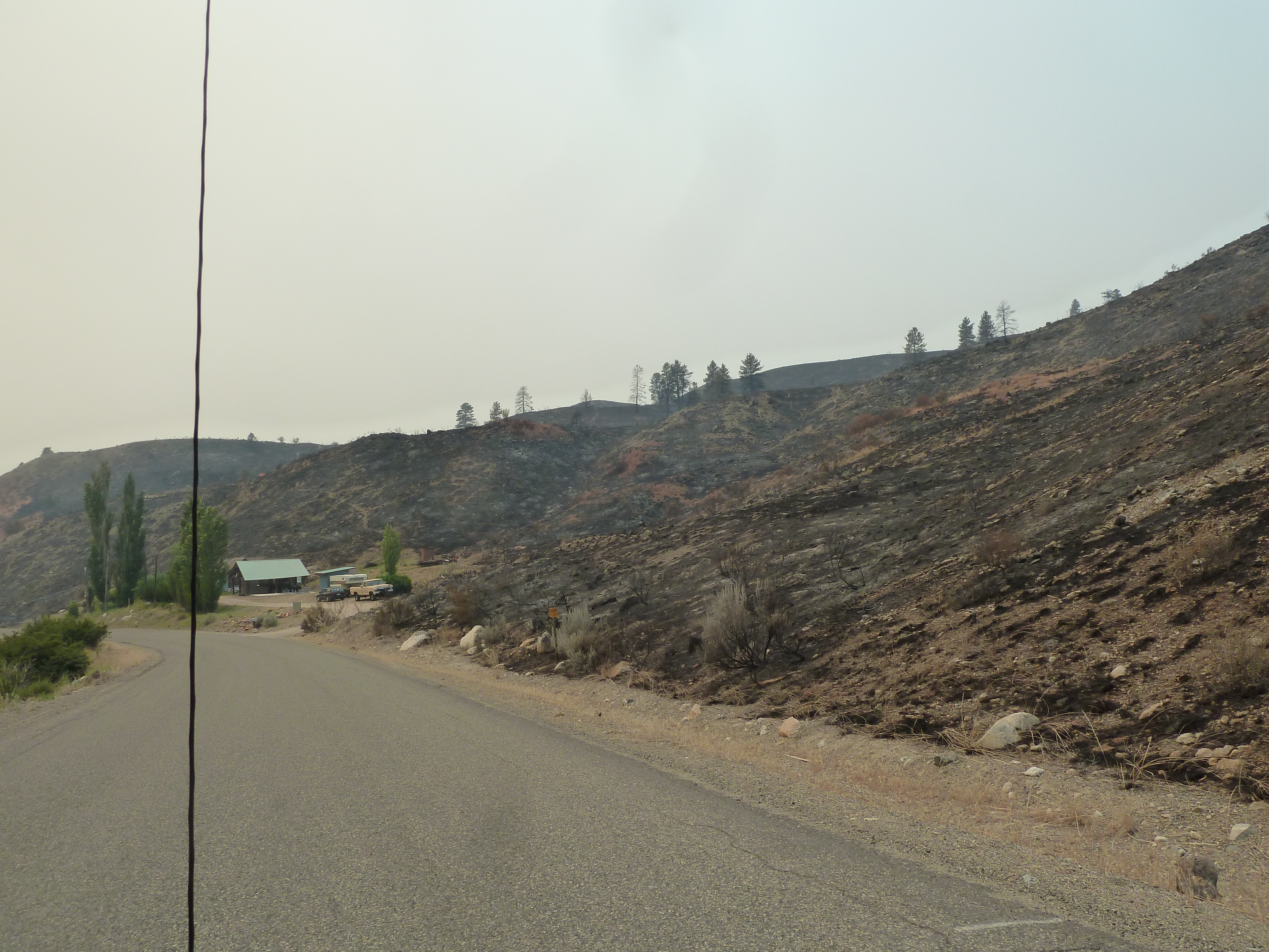
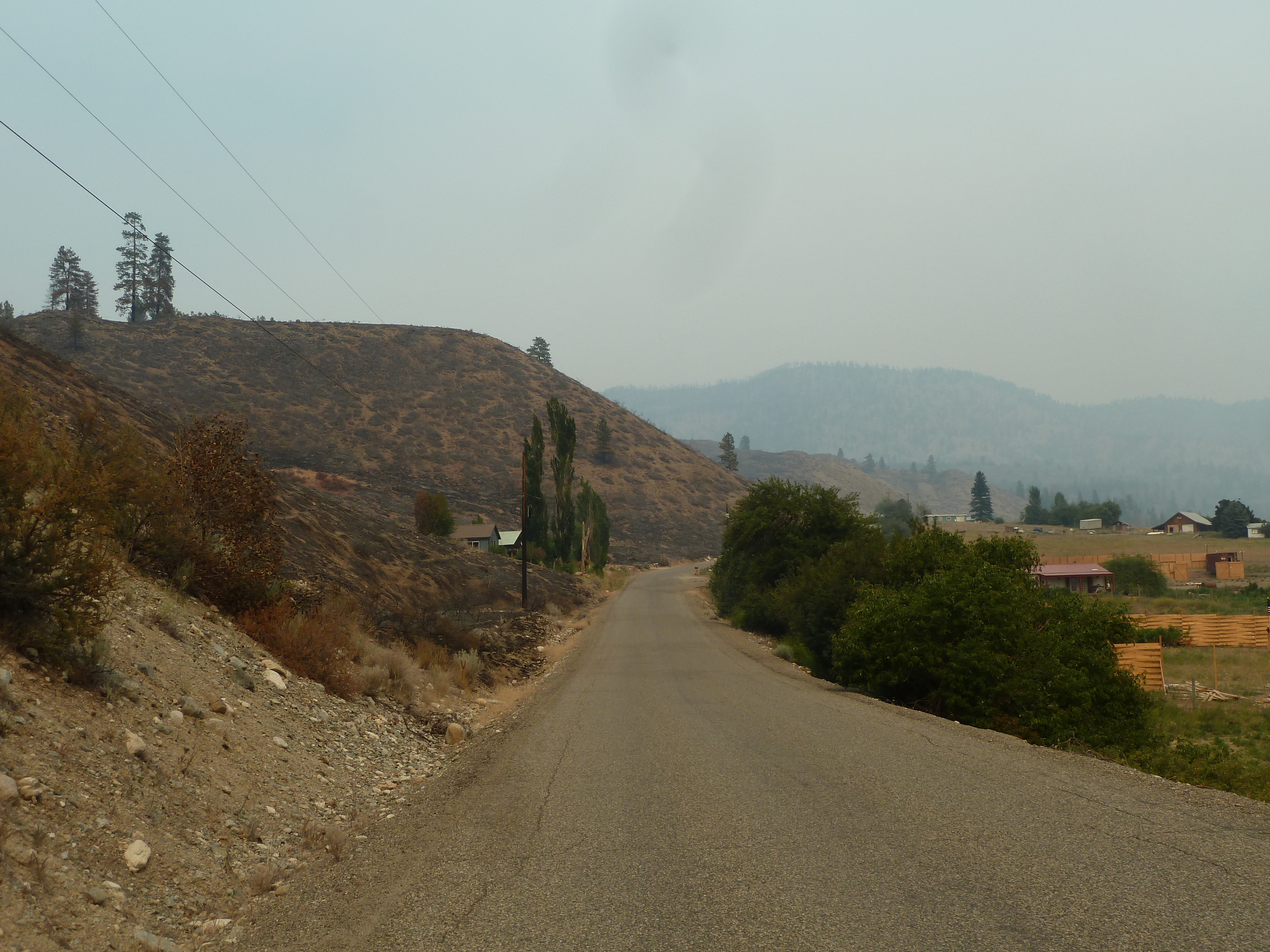
 Through the efforts of fire crews and homeowners, all homes were saved except for the one noted above, and another up in the hills. The ones up on or against the hillsides are surrounded with charred land, but the ones down on the main valley floor are pretty much as before, including our former home at 102 Benson Creek Rd. It is between the road and the irrigated fields, and surrounded with a large green lawn (and also has non-flammable siding). Lots of lessons to be learned here.
We haven’t driven down valley yet, or over the Loup. For one thing, the fire is still very much not “out” and there are over 3000 fire personnel from all over the country here. They are gaining on containment, but there are some problematic areas that could still blow up again, and it is hot and dry again this week. We want to stay out of the way, and have no need to just go look at the burned areas.
Daily updates from Incident Management Teams : Official Carlton Complex Fire Information
The unfolding story is recovery. Maybe 300 homes lost, and lots of damage to infrastructure and farming and ranching losses. They have been inundated with goods donations, which is wonderful but is now getting to be overwhelming. They are asking for NO MORE GOODS donations… what is needed is money to funds and agencies who will be helping folks with long-term recovery. Please consider the following:
Community Foundation of North Central Washington Fire Relief Fund
And by the way – the whole Methow Valley is not burned up!! It is just as beautiful as ever up here, especially north of Twisp and on up to the North Cascades National Park.

Leave a comment